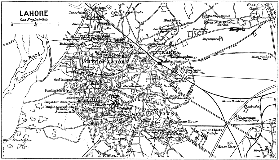
Description: A city plan from 1912 of Lahore, Pakistan. At the time the city was part of the British India Punjab province. The plan shows the major thoroughfares, railways and railway stations, hospitals, military installations, government buildings, and historic sites of the city at the time. The city wall of Lahore is shown, and the districts of Naulakha, Anarkalia, and Donald Town.
Place Names: Pakistan,
ISO Topic Categories: society,
transportation
Keywords: Lahore, transportation, �historical, roads,
railroads, society,
transportation, Unknown, 1912
Source: Ernest Rhys, Ed., A Literary and Historical Atlas of Asia (New York, NY: E.P. Dutton & CO., 1912) 142
Map Credit: Courtesy the private collection of Roy Winkelman |
|