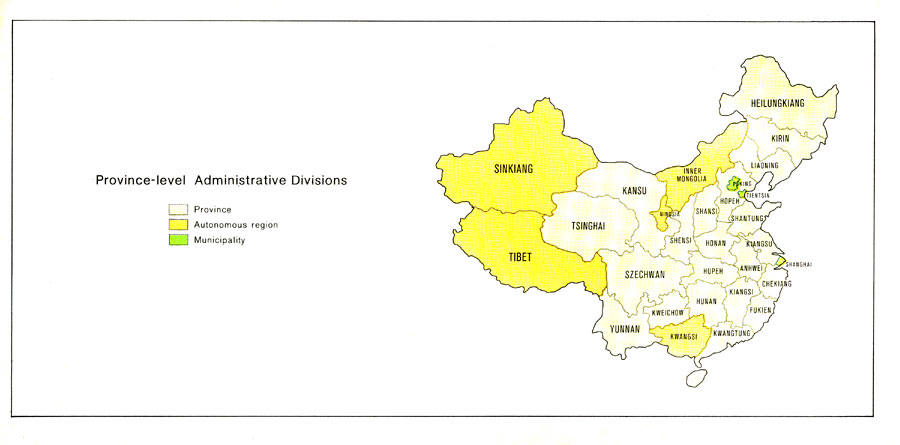
Description: A map from 1971 of China showing the province–level administrative divisions at the time, including China's provinces shown in tan, autonomous regions in orange, and two municipalities in green (Peking and Tientsin on the map).
Place Names: China, Sinkaing, �Tibet, �Tsinghai, �Szechwan, �Kansu, �Yunnan, �Kweichow, �Kwangsi, �Hunan, �Shensi, �Shansi, �Fukein, �Heilungkian
ISO Topic Categories: society,
boundaries
Keywords: China's Province-level Administrative Divisions, political, major political subdivisions, society,
boundaries, Unknown, 1971
Source: Central Intelligence Agency, People's Republic of China Atlas (Washington, DC: U.S. Government Printing Office, 1971) 33
Map Credit: Courtesy the private collection of Roy Winkelman |
|
