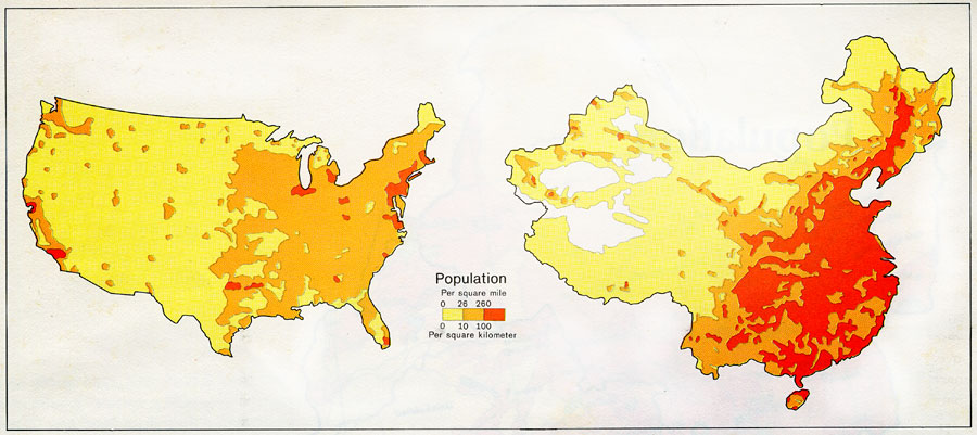
Description: A map from 1971 showing comparative population distribution patterns of China and the United States. The map illustrates the terrain barriers to population development in China, and the trend to dense populations along the coast and lowland plains of the region, and sparse populations in the interior high plateaus, mountains, and arid basins to the west. This map gives density figures in inhabitants per square mile (0 to over 260), and in inhabitants per square kilometer (0 to over 100).
Place Names: China,
ISO Topic Categories: society
Keywords: Population Distribution of China, statistical, kPopulation, population, society, Unknown, 1971
Source: Central Intelligence Agency, People's Republic of China Atlas (Washington, DC: U.S. Government Printing Office, 1971) 37
Map Credit: Courtesy the private collection of Roy Winkelman |
|