Description: A map from 1903 of Nepal showing mountain ranges, rivers, cities, and borders.
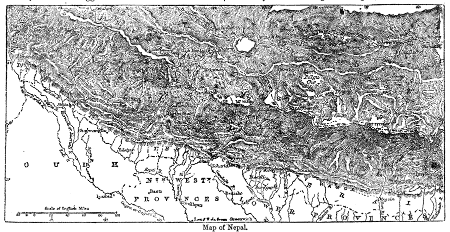
"Nepal, Nepaul, or Nipal, is a small independent state, situated on the north-eastern frontier of Hindustan. It lies between 80° 15’ and 88° 10’ E. long. and 26° 20’ and 30° 10’ N. lat. Its extreme length is about 525 miles, and in breadth it varies from 90 to 140 miles. It is bounded on the N. by Tibet; on the E. by Sikhim and the British district of Darjeeling; on the S. by the British districts of Purniah, Bhagalpur, Darbhanga, Muzaffarpur, Champarun, Gorakhpu, and Oudh; and on the W. by Kumaon, from which it is separated by the Kali river. Its population is estimated by the natives at about 5,000,000, the common phrase used by the rulers in speaking of popular opinion being, ’but what will the Bawan [i.e., fifty-two] Lakh say to this.‘ Probably, however, this is an exaggerated statement." —Kellogg, 1903.
Place Names: Nepal, Kathmand
ISO Topic Categories: boundaries,
inlandWaters
Keywords: Nepal, physical, �political, physical features,
topographical, country borders,
major political subdivisions, boundaries,
inlandWaters, Unknown,1903
Source: Day Otis Kellogg, Encyclopædia Britannica Vol. XVII (New York, NY: Werner Company, 1903) 340
Map Credit: Courtesy the private collection of Roy Winkelman |
|