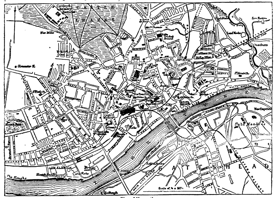
Description: A map of Newcastle, England from 1903, showing roads, railroads, the river Tyne, and other features. The North Eastern Railway and the Central Railway Station are indicated on the map. "Newcastle, or in full, for the sake of distinction, Newcastle-upon Tyne, a city (with the constitution of a county), municipal and parliamentary borough, market-town, and seaport in the county of Northumberland, England, is situated on the north bank of the river Tyne, 8 miles above its mouth, and on the main line of the North-Eastern Railway, 275 miles north of London and 70 east of Carlisle. Some of the streets in the older portion of the town along the river side are narrow and steep, and still contain several of the quaint gable-fronted houses of the time of Elizabeth. The business portions of the town—principally erected from the plans of Richard Grainger—are characterized generally by spacious streets with imposing buildings and fine shops; and in the northern and western suburbs there are numerous terraces and villas inhabited by the wealthier classes. The important town of Gateshead, on the south side of the river, is connected with Newcastle by three bridges—a high level bridge, an hydraulic swing bridge, and a suspension bridge. The high level bridge has been already described. The hydraulic swing bridge, on the low level a little farther down the river, was built to replace a stone structure erected in 1781 on the site of a bridge dating from 1250, and destroyed by a flood in 1771. The Roman bridge, the Pons &Aelig;lii, probably built by the emperor Hadrian, is said to have spanned the river at the same point. The hydraulic bridge was begun in 1868, and opened fro traffic 15th June 1876, at a cost of about £200,000. It consists of one large centre pier, two midstream piers, and two abutments; and its foundations are iron cylinders resting on the solid rock, 60 feet below the bed of the river. Two spans, which open simultaneously by machines impelled by steam, allow 103 feet of waterway for vessels going up and down the river. About half a mile farther up the stream is the Redheugh bridge, commenced in 1867, and opened in 1871 at a cost of £40,000." —Kellogg, 1903
Place Names: United Kingdom, Newcastle, �England, �River Tyne, �Tyne Rive
ISO Topic Categories: inlandWaters,
transportation
Keywords: Plan of Newcastle, physical, �transportation, physical features, roads,
railroads, inlandWaters,
transportation, Unknown,1903
Source: Day Otis Kellogg, Encyclopædia Britannica Vol. XVII (New York, NY: Werner Company, 1903) 378
Map Credit: Courtesy the private collection of Roy Winkelman |
|