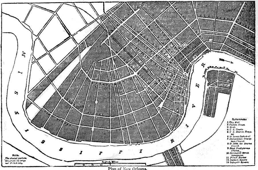
Description: A plan from 1903 of the city of New Orleans, showing roads, the Mississippi River, and important landmarks. Landmarks indicated on the map include the: City Hall, Custom House, Mint, U.S. Courts, U.S. Marine Hospital, St. Louis Cathedral, Immaculate Conception Church, St. John the Baptist Church, First Presbyterian Church, Carondelet Street Synagogue, French Market, Jackson Square, and Lafayette Square.
Place Names: Louisiana, New Orlean
ISO Topic Categories: transportation,
structure,
inlandWaters
Keywords: Plan of New Orleans, physical, �transportation, physical features, roads, transportation,
structure,
inlandWaters, Unknown,1903
Source: Day Otis Kellogg, Encyclopædia Britannica Vol. XVII (New York, NY: Werner Company, 1903) 403
Map Credit: Courtesy the private collection of Roy Winkelman |
|