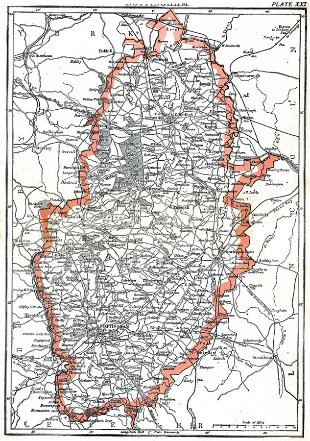
Description: A map of the English county of Nottingham in 1903 showing cities, rivers, mountains, railroads, and parks. "Nottingham of Notts, an inland county of England, is bounded N. by Yorkshire and Lincolnshire, W. by Derbyshire, S. by Leicestershire, and E. by Lincolnshire. It is of an irregular oval shape, its length form north to south being about 50 miles, and its greatest breadth from east to west about 25 miles. The area is 527,752 acres, or nearly 825 square miles." —Kellogg, 1903
Place Names: United Kingdom, Nottingham, �Notts, �England,
ISO Topic Categories: transportation,
inlandWaters,
boundaries
Keywords: Nottingham, physical, �political, �transportation, physical features,
topographical, county borders, roads,
railroads, transportation,
inlandWaters,
boundaries, Unknown,1903
Source: Day Otis Kellogg, Encyclopædia Britannica Vol. XVII (New York, NY: Werner Company, 1903) 596
Map Credit: Courtesy the private collection of Roy Winkelman |
|