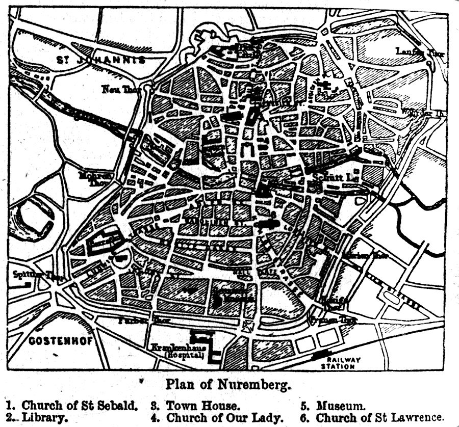
Description: A map of the Bavarian town of Nuremberg in 1903 showing roads, a railroad, and important buildings. Buildings on the map include the: Church of St. Sebald, Library, Town House, Church of Our Lady, Museum, Church of St. Lawrence.
Place Names: Germany, Nuremberg, �Middle Franconia, �Bavaria, �Nürnber
ISO Topic Categories: transportation,
inlandWaters,
structure
Keywords: Plan of Nuremberg, physical, �transportation, physical features, roads, transportation,
inlandWaters,
structure, Unknown,1903
Source: Day Otis Kellogg, Encyclopædia Britannica Vol. XVII (New York, NY: Werner Company, 1903) 662
Map Credit: Courtesy the private collection of Roy Winkelman |
|