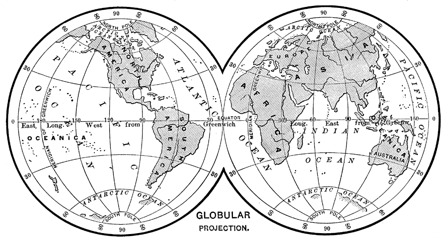
Description: This is a globular projection of the earth from 1890. In order to show the spherical earth on a flat map, some distortions are inevitable. Globular map projections provide accurate relative sizes of landmasses, but direction is distorted.
Place Names: A Complete Map of Globes and Multi-continent, Africa, �Antarctica, �Asia, �Australia, �Europe, �North America, �South America, �Atlantic Ocean, �Indian Ocean, �Pacitfic Ocean, �Oceanica,
ISO Topic Categories:
Keywords: Globular Projection of the Earth, physical, �globular projection, �map projections, �physical features, Unknown,
Unknown,1890
Source: William H. Brewer Ph.,D., Warren's New Physical Geography (Philadelphia, PA: Cowperthwait and Company, 1890) 10
Map Credit: Courtesy the private collection of Roy Winkelman |
|