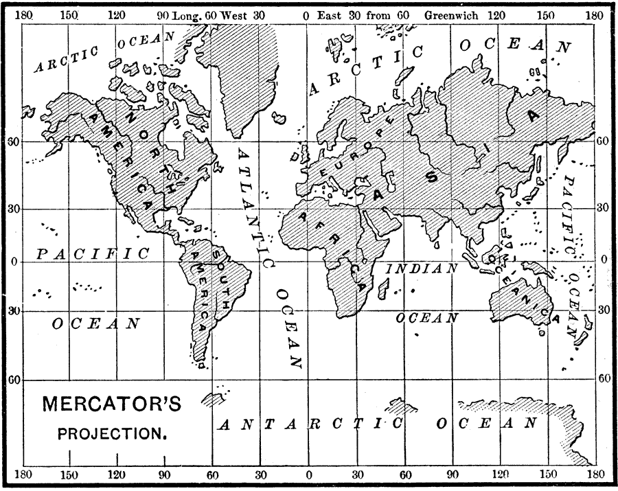
Description: This is Mercator's projection of the earth from 1890. In order to show the spherical earth on a flat map, some distortions are inevitable. In Mercator's projection, "The directions are correct, but the size of the countries is distorted, the relative size of those portions of the surface situated near the poles being much increased. This projection is, however, more used than any other in Physical Geography, because any given direction is a straight line on the map. For this reason it is also employed for all sea–charts in use by navigators." (— Brewer, 1890)
Place Names: A Complete Map of Globes and Multi-continent, Africa, �Antarctica, �Asia, �Australia, �Europe, �North America, �South America, �Pacific Ocean, �Pacific Ocean, �Indian Ocean, �Antarctic Ocean, �Arctic Ocean, �Oceanica,
ISO Topic Categories:
Keywords: Mercator's Projection of the Earth, physical, �map projections, �mercator projections, kMapProjection, physical features, Mercator, 1890
Source: William H. Brewer Ph.,D., Warren's New Physical Geography (Philadelphia, PA: Cowperthwait and Company, 1890) 10
Map Credit: Courtesy the private collection of Roy Winkelman |
|