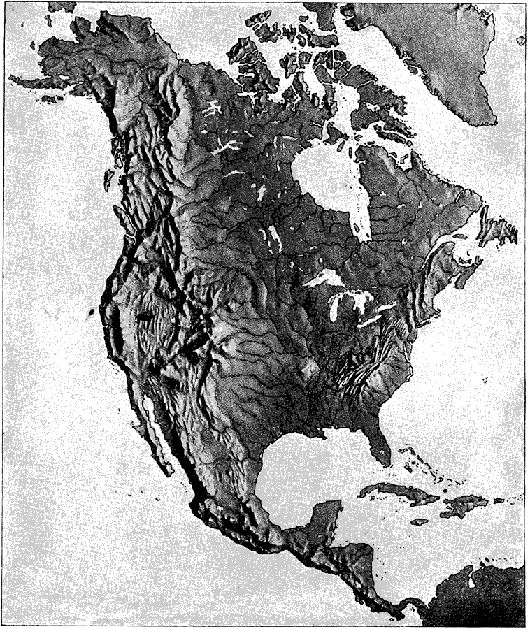
Description: A relief map from 1890 of North America, Central America, Greenland, and the Caribbean to Puerto Rico showing the general mountain systems, highlands, and plains of the region. Major river systems are shown. "North America is the third continent with reference to size, and the predominate mountain-system occupies all the western part for its entire length- a distance of 5700 miles. This system is known as the Cordilleras of North America, or sometimes as the Pacific System, and is part of that greater system which extends from Cape Horn to the Arctic Ocean, the greatest mountain-system of the globe in all respects except height." — Brewer, 1890.
Place Names: A Complete Map of North America, Bahamas, �Canada, �Cuba, �Mexico, �United States, �Central America,
ISO Topic Categories: elevation,
inlandWaters
Keywords: Relief of North America, physical, �relief maps, kRelief, physical features, elevation,
inlandWaters, Unknown, 1890
Source: William H. Brewer Ph.,D., Warren's New Physical Geography (Philadelphia, PA: Cowperthwait and Company, 1890) 33
Map Credit: Courtesy the private collection of Roy Winkelman |
|