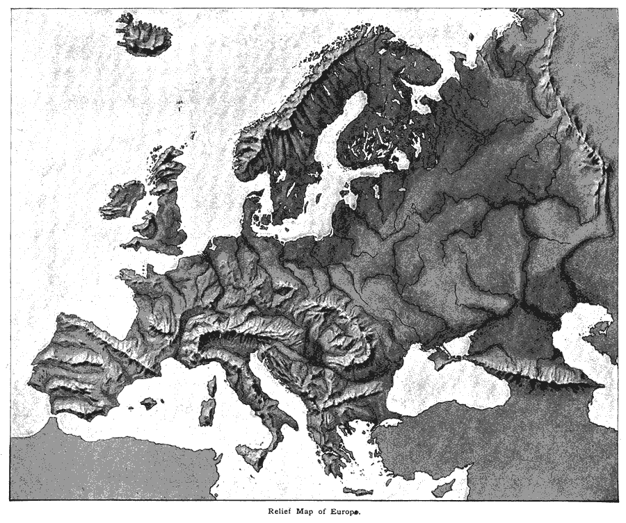
Description: "The relief–forms of Europe are vastly more complicated than those of either the Americas, Africa, or Australia. The general trend of the greatest mountain–chains is east and west, but the earth's crust has here been so crumpled that ranges may be found extending toward any point of the compass. This complexity of structure produces many valleys and basins enclosed by mountains and favorable for the existence of many small separate and independent nations. This feature has played a most interesting part in European history. To this complexity of structure is also due the extended coast–line and the many indentations and peninsulas." (— Brewer, 1890)
Place Names: A Complete Map of Europe, France, �Germany, �Greece, �Italy, �Poland, �Portugal, �Romania, �Spain, �Sweden, �United Kingdo
ISO Topic Categories: elevation,
inlandWaters
Keywords: Relief Map of Europe, physical, �elevation, �relief maps, kRelief, physical features, elevation,
inlandWaters, Unknown, 1890
Source: William H. Brewer Ph.,D., Warren's New Physical Geography (Philadelphia, PA: Cowperthwait and Company, 1890) 36
Map Credit: Courtesy the private collection of Roy Winkelman |
|