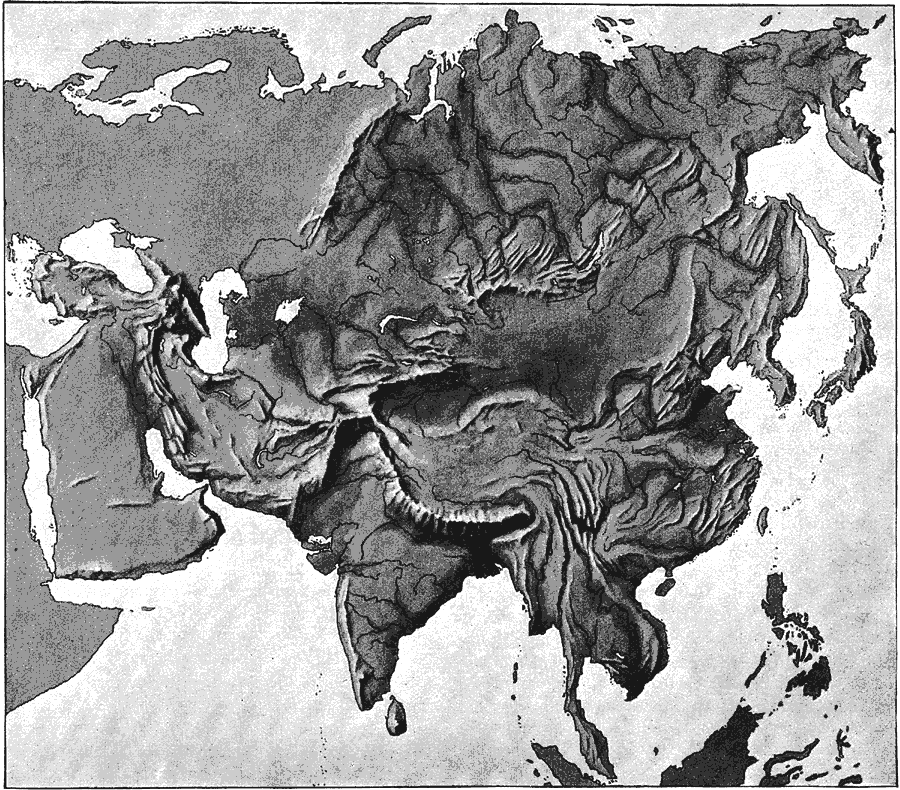
Description: A relief map from 1890 of Asia showing terrain features of the region including mountain systems, plateaus and basins, lakes, river systems, coastal features, and islands. "As North America and South America resemble each other in the arrangement of their form of relief, so do Europe and Asia. In both the predominant systems are in the south, surrounded on three sides by the secondary systems, while the great low plains lie near the outside of the continent. But as Asia is the largest of the continents, so also are its mountains the highest and its plateaus the most massive in elevation and extent. The predominant system is the great Plateau of Thibet [sic] with its mountain-barriers, the Himalaya, Karakorum, Kuen-Lun, and Yungling Mountains. The average elevation of Thibet [sic] is 14,000 feet – i.e., nearly equal to that of the highest peaks in the Rocky Mountains- and its area is 250,000 square miles. The Himalaya Mountains rise upon its southern border, sloping abruptly from an elevation of 18,000 feet down to the tropical low plains of the Ganges. Mount Everest (29,002 feet), Kunchinginga (28,158 feet)- the highest mountains in the world- are two of the colossal mountain-peaks which crown the crest. The Karakorum and Kuen-Lun chains trends east and west, and are nearly as high as the Himalaya. The Kuen-Lun Mountains bond Thibet [sic] on the north." (— Brewer, 1890)
Place Names: A Complete Map of Asia, China, �India, �Indonesia, �Japan, �Kazakhstan, �Mongolia, �Pakistan, �Philippines, �Russia, �Thailan
ISO Topic Categories: elevation,
environment,
geoscientificInformation,
inlandWaters
Keywords: Relief Map of Asia, kRelief, elevation,
environment,
geoscientificInformation,
inlandWaters, Unknown, 1890
Source: William H. Brewer Ph.,D., Warren's New Physical Geography (Philadelphia, PA: Cowperthwait and Company, 1890) 37
Map Credit: Courtesy the private collection of Roy Winkelman |
|