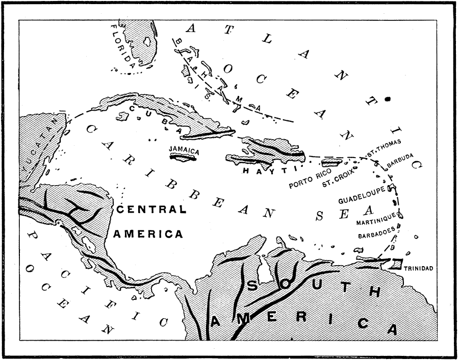
Description: A map from 1890 of the West Indies region showing the highland structure of the island chains and groups, and illustrating the Caribbean Sea as an enclosed basin. This map also shows the Bahamas as a separate structure not related to the Antilles. "The West India Islands, which are principally the summits of a submarine mountain-chain, which sweeps in a curve from a Yucatan to the eastern termination of the Venezuela coast-range. The Bahama Islands belonging clearly by situation and structure to the low plains of the Floridian Peninsula." — Brewer, 1890, p. 41.
Place Names: A Regional Map of North America, Bahamas, �Cuba, �Jamaica, �Hayti, �Haiti, �Porto Rico, �Puerto Rico, �Dominican Republic, �St. Croix, �St. Thomas, �Barbuda, �Barbados, �Guadeloupe, �Martinique, �Barbadoes, �Trinidad, �South America, �Central America, �Florida, �Caribbean Sea, �Atlant
ISO Topic Categories: boundaries,
geoscientificInformation,
inlandWaters
Keywords: West India Island Chains, physical, �island formation, kCaribbean, physical features, boundaries,
geoscientificInformation,
inlandWaters, Unknown, 1890
Source: William H. Brewer Ph.,D., Warren's New Physical Geography (Philadelphia, PA: Cowperthwait and Company, 1890) 41
Map Credit: Courtesy the private collection of Roy Winkelman |
|