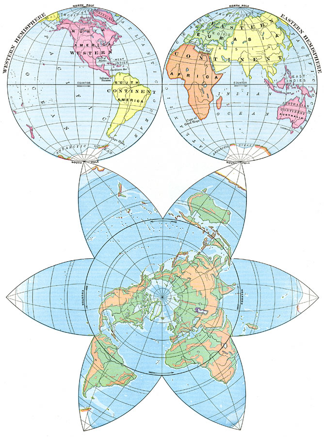
Description: A world map from 1898, showing the earth as East Hemisphere and West Hemisphere at the top, and showing the "Continental Plateau" in the star–shaped map below. The hemisphere maps use the mapping convention of dividing the earth, bound by the 20° W and 160° E meridians with the Equator running midway between the poles. The star–shaped map has the North Pole at the center, with the Equator being the large circle of the body of the star.
Place Names: A Complete Map of Globes and Multi-continent, Africa, �Antarctica, �Asia, �Australia, �Europe, �North America, �South America, �Western Hemisphere, �Eastern Hemisphere, �Polar, �Pacific Ocean, �Atlantic Ocean, �Indian Ocean, �Antartic Ocean, �Artic Ocea
ISO Topic Categories: boundaries,
elevation,
oceans
Keywords: Star-Shaped and Hemisphere Maps of the Earth, physical, �political, �historical, physical features,
topographical, major political subdivisions, boundaries,
elevation,
oceans, Unknown,1898
Source: Jacques W. Redway and Russell Hinman, Natural Advanced Geography (New York, NY: American Book Company , 1898) 8
Map Credit: Courtesy the private collection of Roy Winkelman |
|