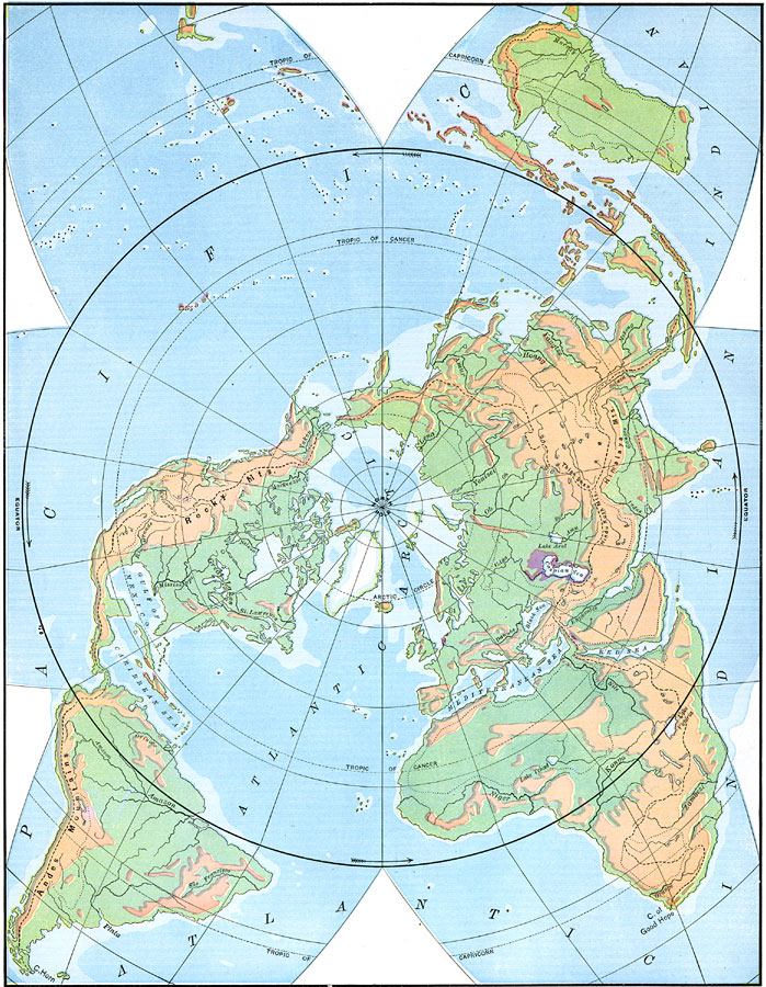
Description: A star–shaped world map from 1898 showing the earth from a northern polar perspective, with the equator circling the body of the star. This map is color–coded to show general highlands and lowlands, the areas around the Caspian Sea and Red Sea that are below sea level, and the submerged portions of the continental plateau. The map shows major rivers and the land slope divides that determine the direction of river drainage.
Place Names: A Complete Map of Globes and Multi-continent, Africa, �Asia, �Australia, �Europe, �North America, �South America, �Atlantic Ocean, �Pacific Ocean, �Indian Ocea
ISO Topic Categories: boundaries,
elevation,
oceans,
inlandWaters
Keywords: Star-Shaped Map of the Earth with Polar Projection, physical, �historical, physical features,
topographical, boundaries,
elevation,
oceans,
inlandWaters, Unknown,1898
Source: Jacques W. Redway and Russell Hinman, Natural Advanced Geography (New York, NY: American Book Company , 1898) 16
Map Credit: Courtesy the private collection of Roy Winkelman |
|