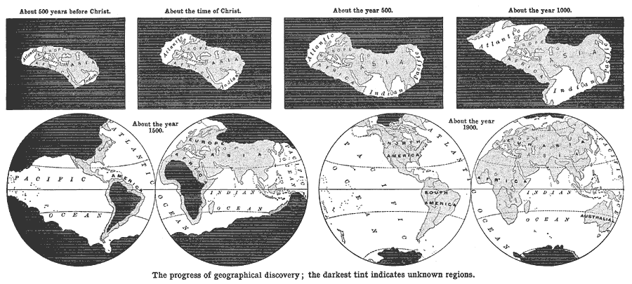
Description: A map from 1898 showing the regions of the world known to Europeans at various points in time. This series of maps shows the progression of geographic discovery by Europeans from the time of the Greeks adding England and India to their maps (500 BC), the time of the cartographers Strabo and Ptolemy (around the time of Christ), the time of the cartographers Hierocles and Stephanus during the Byzantine Empire (AD 500), the period of Islamic and Norse exploration (AD 1000), the beginning of the Age of Discovery, with the voyages of Columbus, De Gamma, Cabot, and Magellan (around AD 1500), to the known world about the year 1900. "The maps above indicate the gradual growth of man's knowledge of the world after he became civilized enough to leave such a record of what he knew upon the subject." —Redway, 1898.
Place Names: A Complete Map of Globes and Multi-continent, Antarctica, �Africa, �Asia, �Australia, �Europe, �North America, �South Americ
ISO Topic Categories: society
Keywords: The Progress of Geographical Discovery, historical, society, Unknown,500 BC to AD 1900
Source: Jacques W. Redway and Russell Hinman, Natural Advanced Geography (New York, NY: American Book Company , 1898) 35
Map Credit: Courtesy the private collection of Roy Winkelman |
|