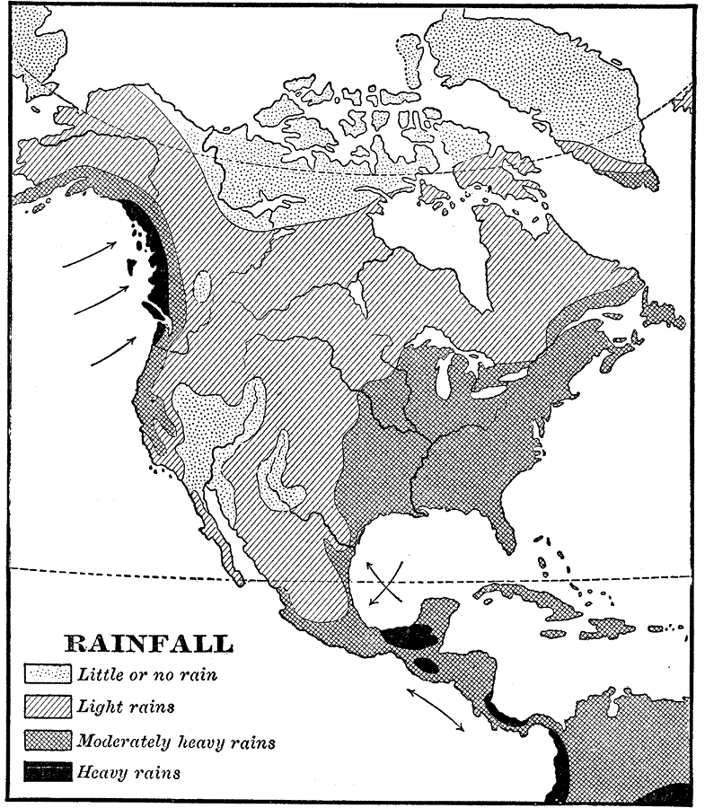
Description: A map from 1898 of North America, Central America, Greenland, and the Caribbean to Puerto Rico showing the general distribution of rainfall in the region. The map shows areas of little or no rainfall to areas of heavy rainfall. The map also shows the direction of prevailing trade winds indicating their effect on rainfall distribution. "Along the northwest coast the prevailing westerly winds deposit copious rainfall as they ascend the abrupt slope of the great highland region...the climate in the region north of the Gulf of California is quite dry. In the southern part of North America the northeast trade winds bring copious rains to the east slopes in the winter half of the year; but in summer, when the heat equator lies farthest north, monsoon winds blow toward it from the Pacific and bring rain to the southwest coasts. Farther north, the westerly winds, which have lost their moisture on the west side of the mountains, reach the plateaus as dry winds. In the eastern half of the grand division, however, where the southerly winds in cyclones bring vapor from the Gulf of Mexico and the Atlantic, there is abundant rainfall." — Redway, 1898.
Place Names: A Complete Map of North America, Bahamas, �Canada, �Cuba, �Mexico, �United States, �Central Americ
ISO Topic Categories: climatologyMeteorologyAtmosphere
Keywords: Rainfall in North America, meteorological, �historical, kPrecipitation, rainfall, climatologyMeteorologyAtmosphere, Unknown,1898
Source: Jacques W. Redway and Russell Hinman, Natural Advanced Geography (New York, NY: American Book Company , 1898) 46
Map Credit: Courtesy the private collection of Roy Winkelman |
|
