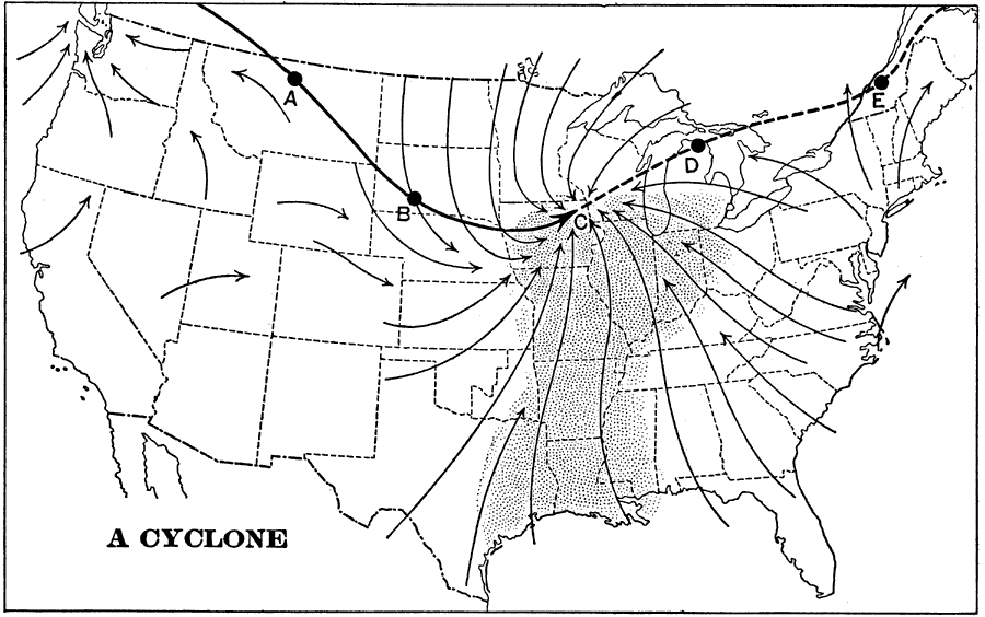
Description: A map from 1898 showing typical cyclone formation and movement in North America. "The effect of a cyclonic storm upon the weather is illustrated by the chart...The point of the heavy arrow lies in a storm center, around and into which the winds are whirling, as shown by the light arrows. To the east of the center the winds come from the south and southeast and make the weather warm...[on the western side of the storm the winds come from the north] these winds bring cool or cold weather to that region...The storm center is moving all the time...thus, as the storm drifts rapidly eastward over the country, it pushes warmer weather along in front of it, and drags colder weather along in its rear." — Redway and Hinman, 1898, p. 54.
Place Names: Meteorology,
ISO Topic Categories: climatologyMeteorologyAtmosphere
Keywords: A Cyclone in the United States, meteorological, �weather, �cyclone, �historical, kClimate, climatologyMeteorologyAtmosphere, Unknown,1898
Source: Jacques W. Redway and Russell Hinman, Natural Advanced Geography (New York, NY: American Book Company , 1898) 54
Map Credit: Courtesy the private collection of Roy Winkelman |
|