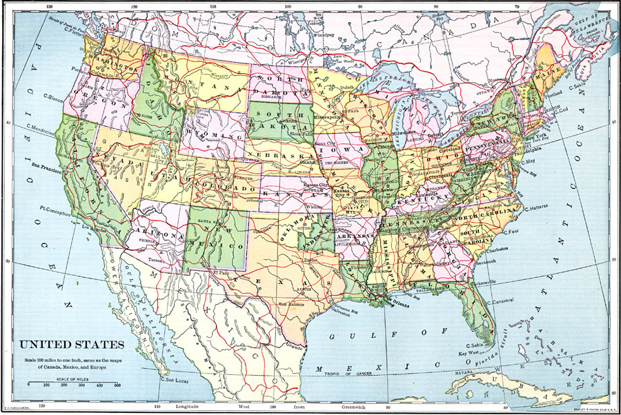
Description: A map from 1898 of the ‘lower forty–eight’ United States showing state boundaries and state capitals, major cities and towns, railroads, mountain systems, lakes, rivers, and coastal features. This map shows the Indian Territory in eastern Oklahoma at the time.
Place Names: A Complete Map of the United States, Boston, �Chicago, �Los Angeles, �New Orleans, �New York, �Seattle, �Washington D.C., �Indian Territor
ISO Topic Categories: transportation,
boundaries,
elevation,
inlandWaters,
oceans
Keywords: United States, physical, �political, �transportation, �historical, physical features,
topographical, country borders,
major political subdivisions, roads,
water routes, transportation,
boundaries,
elevation,
inlandWaters,
oceans, Unknown,1898
Source: Jacques W. Redway and Russell Hinman, Natural Advanced Geography (New York, NY: American Book Company , 1898) 56
Map Credit: Courtesy the private collection of Roy Winkelman |
|