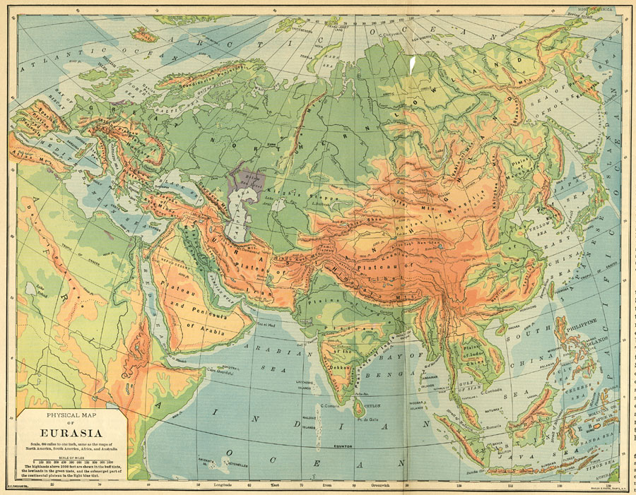
Description: A physical map of Eurasia, as of 1898 AD. "The great Eurasian highland extends as a continuous region of elevation from Bering Strait to the Mediterranean Sea. It is cut entirely through by the outlet from the Black Sea, but extends through southern Europe as a broken and much narrower highland to the Spanish Peninsula. In central Asia this vast highland is a s wide as the United States from San Francisco to Chesapeake bay. There is no continuous mountain chain traversing the great highland, as in America, but from Bering Strait to the Strait of Gibraltar there is a broken succession of mountain ranges. Between them are broad desert plateaus which differ greatly in elevation. The small, rugged Pamir plateau and the extensive but smoother plateau of Tibet are about three miles in elevation, while the great plateaus to the northeast and southwest of them are not one third as high. The mountain ranges rise from one to three miles above the surface of the plateaus, and some of them are the highest in the world...Much of the great northern lowland has an elevation of less than 500 feet, and in places it is actually below sea level...In general its flat surface is broken only by the low bluffs which border the broad flood plains of the streams. The detached lowland plains to the east and south of the highlands are composed of alluvium washed from the bordering mountains, and their upheaval is thought to have been comparatively recent." &mdashRedway, 1898.
Place Names: Regional EurAsia, Africa, �Asia, �Europe, �East Indies, �Himalaya Mountains, �Pacific Ocean, �Japan, �China, �India, �Arabia, �Iran, �Great Northern Lowland, �Indian Ocean, �Arabian Sea, �Red Sea, �Mediterranean Sea, �Atlantic Ocean, �Artic Ocea
ISO Topic Categories: physical, �transportation, �historical, kWorldEurasia
Keywords: Physical Map of Eurasia, physical, �transportation, �historical, physical features,
topographical, water routes, physical, �transportation, �historical, kWorldEurasia, Unknown,1898
Source: Jacques W. Redway and Russell Hinman, Natural Advanced Geography (New York, NY: American Book Company , 1898) 112-113
Map Credit: Courtesy the private collection of Roy Winkelman |
|