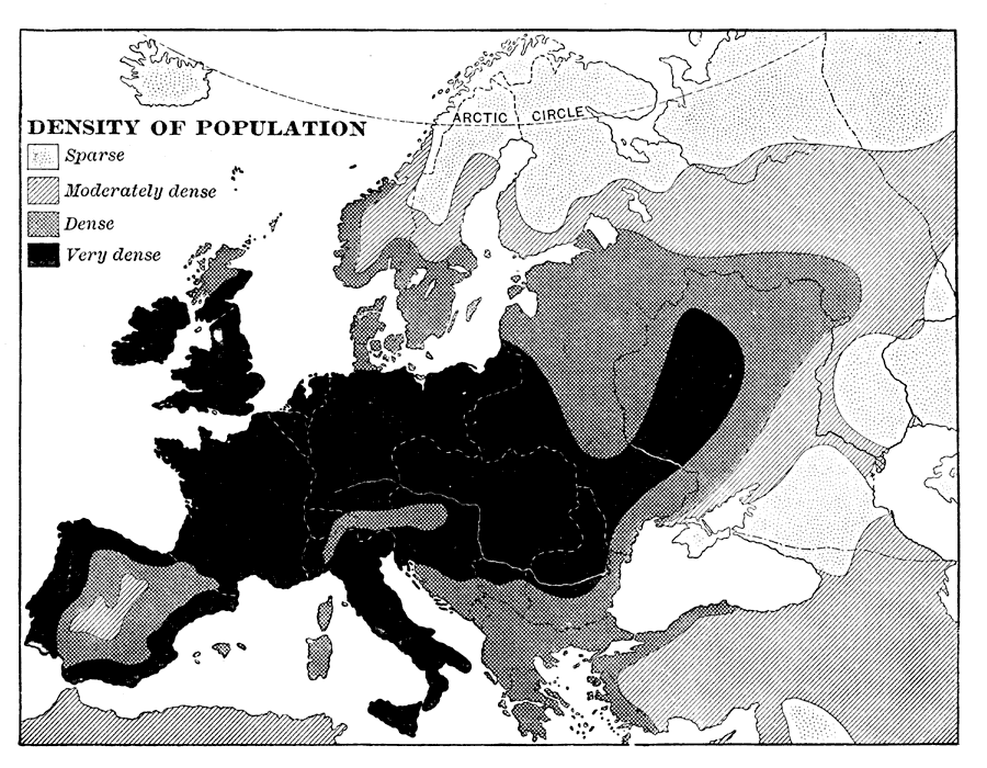
Description: A map showing the Density of Population of Europe in 1898. "Europe, though little larger than the United States, contains five times as many inhabitants, and hence is much more densely peopled...Europe is composed of twenty or more independent states or countries, in nearly every one of which the people differ from those of others in language, customs, and standards of living." — Redway, 1898.
Place Names: A Complete Map of Europe, France, �Germany, �Greece, �Italy, �Poland, �Portugal, �Romania, �Spain, �Sweden, �United Kingdo
ISO Topic Categories: society
Keywords: Density of Population of Europe, statistical, �historical, kPopulation, population, society, Unknown,1898
Source: Jacques W. Redway and Russell Hinman, Natural Advanced Geography (New York, NY: American Book Company , 1898) 117
Map Credit: Courtesy the private collection of Roy Winkelman |
|