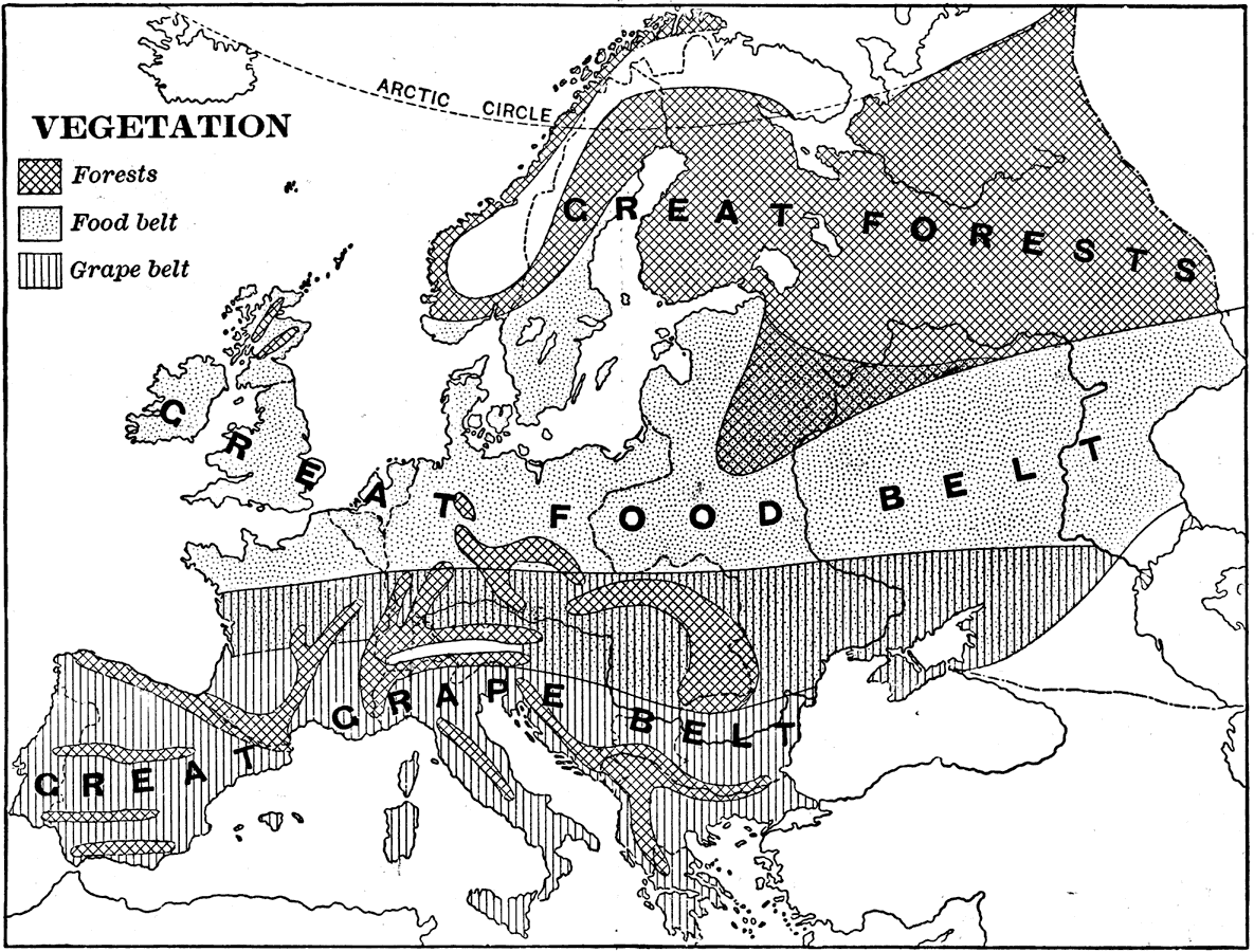
Description: A map showing Vegetation in Europe as of 1898. "The great agricultural regions are (1) the northern lowland from the Atlantic eastward through southern Russia, and (2) the broad fertile valleys of the Danube, the Po, the Rhone, and the streams of the Spanish peninsula. The northern region, including the plains of Hungary, wields three fourths of the rye, oats, wheat, barley, and potatoes, and is the chief food-producing belt. Other crops of this belt are beets, beans, cabbages, and the fibers flax and hemp. In southern Europe large quantities of beans, garlic, and other vegetables are raised, and much grain, including corn and some rice, but the characteristic crop is the grape, for this is the world's greatest wine- and raisin-producing region. Other important crops of southern Europe are olives, oranges, lemons, figs, almonds, and chestnuts. Mulberry trees are also cultivated to afford food for silk-worms, which are extensively reared." — Redway, 1898.
Place Names: A Complete Map of Europe,
ISO Topic Categories: biota,
farming
Keywords: Vegetation in Europe, statistical, �historical, kAgriculture, kBiodiversity, agriculture,
vegetation, biota,
farming, Unknown,1898
Source: Jacques W. Redway and Russell Hinman, Natural Advanced Geography (New York, NY: American Book Company , 1898) 120
Map Credit: Courtesy the private collection of Roy Winkelman |
|