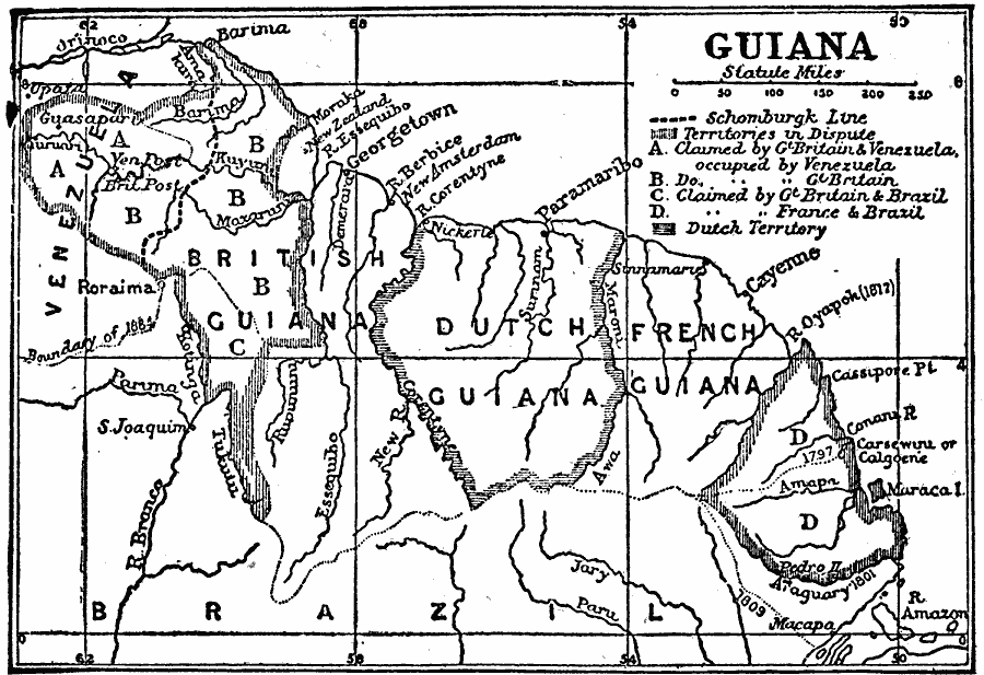
Description: A map from 1910 showing the territorial disputes in the Guianas at the time. The map shows the Schomburgk Line (1840) between Venezuela and British Guiana, the disputed territories claimed by both Venezuela and Great Britain and occupied by Venezuela (A), occupied by Great Britain (B), the territory claimed by both Brazil and Great Britain (C), and the territorial dispute between France and Brazil (D). The map shows the Dutch territory, and boundaries of the Guiana colonies established in 1797, 1801, and 1884.
Place Names: Guyana, British Guiana, �Dutch Guiana, �French Guiana, �Brazil, �Venezuela, �Guian
ISO Topic Categories: boundaries,
inlandWaters,
location,
oceans
Keywords: Guiana Territory Dispute, physical, �political, �borders, �boundaries, physical features, country borders, boundaries,
inlandWaters,
location,
oceans, Unknown, 1902
Source: George W. Conklin, The New Conklin's Handy Manual of Useful Information and Atlas of the World (Chicago, Illinois: The Christian Herald, 1902) 441
Map Credit: Courtesy the private collection of Roy Winkelman |
|