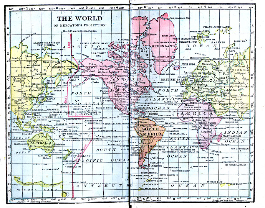
Description: A map of the world from 1906 on a Mercator's Projection, showing the International Dateline in red, and the extent of explored lands in the northern and southern Polar Regions.
Place Names: A Complete Map of Globes and Multi-continent, Africa, �Antarctica, �Asia, �Australia, �Europe, �North America, �South Americ
ISO Topic Categories: boundaries,
inlandWaters,
location,
oceans
Keywords: The World on Mercator's Projection, physical, �political, �borders, �boundaries, kMapProjection, physical features, country borders, boundaries,
inlandWaters,
location,
oceans, Unknown, 1906
Source: George F. Cram , Cram's Quick Reference Atlas and Gazetteer of the World (Chicago , Illinois : George F. Cram Series of Atlases, 1906) 1
Map Credit: Courtesy the private collection of Roy Winkelman |
|