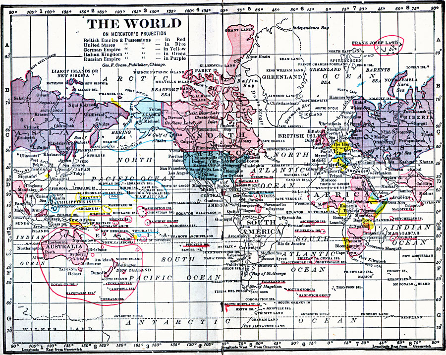
Description: A map of the world from 1906 on a Mercator's Projection. This map is color–coded to show the British Empire and possessions in red, United States and possessions in blue, German Empire and possessions in yellow, Italian Kingdom and possessions in green, and the Russian Empire and possessions in purple. The extent of explored lands and territorial claims in the northern and southern Polar Regions is also shown.
Place Names: A Complete Map of Globes and Multi-continent, Africa, �Antarctica, �Asia, �Australia, �Europe, �North America, �South Americ
ISO Topic Categories: boundaries,
inlandWaters,
location,
oceans
Keywords: The World on Mercator's Projection, physical, �political, �borders, �boundaries, physical features, country borders, boundaries,
inlandWaters,
location,
oceans, Unknown, 1906
Source: George F. Cram , Cram's Quick Reference Atlas and Gazetteer of the World (Chicago , Illinois : George F. Cram Series of Atlases, 1906) 2
Map Credit: Courtesy the private collection of Roy Winkelman |
|