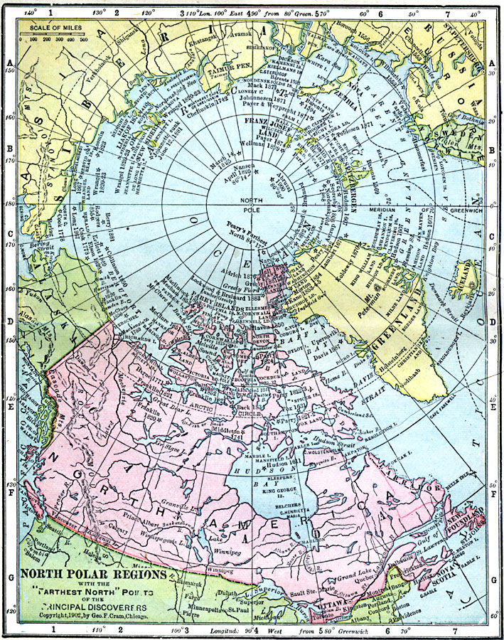
Description: A map of the North Polar Region from 1902 with the "Farthest North" points of the principal discoveries shown by a star symbol with dates given, from the voyages of Hugh Willoughby and Richard Chancellor in 1553 to Robert Peary's 1900 expedition prior to reaching the pole in 1909. The map shows national boundaries in the region, cities and outposts, rivers, lakes, prominent mountains and ranges, and coastal features.
Place Names: Arctic Region, Alaska, �Canada, �Greenland, �Iceland, �Russia, �Swede
ISO Topic Categories: boundaries,
inlandWaters,
location,
oceans
Keywords: North Polar Regions with the "Farthest North" Points of the Principal Discoveries, physical, �topographical, �geological, �political, �borders, �boundaries, �physical features,
topographical, country borders, boundaries,
inlandWaters,
location,
oceans, Unknown, 1553–1902
Source: George F. Cram , Cram's Quick Reference Atlas and Gazetteer of the World (Chicago , IL: George F. Cram Series of Atlases, 1906) 6
Map Credit: Courtesy the private collection of Roy Winkelman |
|