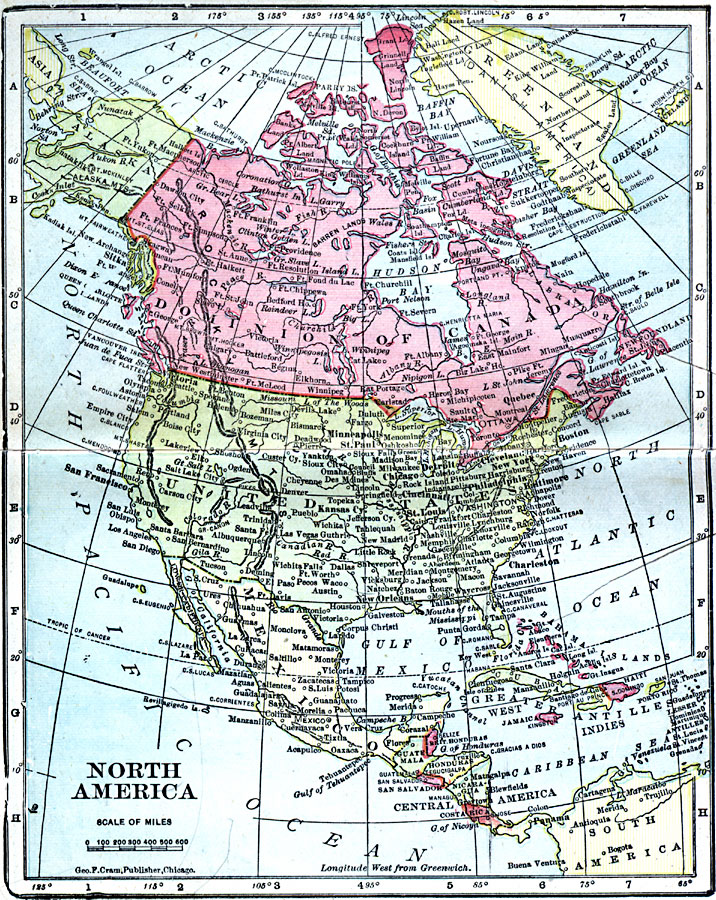
Description: A map from 1906 of North America showing the Dominion of Canada, Greenland or Danish America, the United States, Mexico, Guatemala, British Honduras (Belize), San Salvador (El Salvador), Honduras, Nicaragua, Costa Rica, and the islands of the Caribbean. The map shows capitals and major cities, rivers, mountain systems, and coastal features of the region.
Place Names: A Complete Map of North America, Bahamas, �Canada, �Cuba, �Mexico, �United State
ISO Topic Categories: boundaries,
inlandWaters,
location,
oceans
Keywords: North America, physical, �topographical, �geological, �political, �borders, �boundaries, �physical features,
topographical, country borders, boundaries,
inlandWaters,
location,
oceans, Unknown, 1906
Source: George F. Cram , Cram's Quick Reference Atlas and Gazetteer of the World (Chicago , IL: George F. Cram Series of Atlases, 1906) 7
Map Credit: Courtesy the private collection of Roy Winkelman |
|