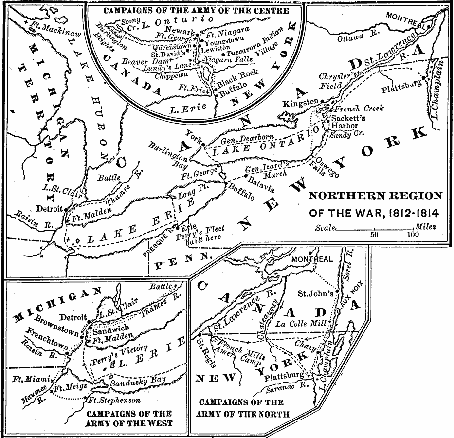
Description: A series of maps showing the northern campaigns, forts, and battle sites during the War of 1812, including details of the campaigns of the Army of the Centre (Lundy's Lane, Beavers Dam, and Burlington Heights), campaigns of the Army of the West (Fort Stephenson, Fort Meigs, and the Battle of the Thames River), campaigns of the Army of the North (French Mills, Montreal, and Plattsburg) and an expanded map of the region showing the campaign routes from the Great Lakes to Montreal on the St. Lawrence River.
Place Names: Growth of Nation, York, �Detroit, �Buffalo, �War of 181
ISO Topic Categories: imageryBaseMapsEarthCover,
intelligenceMilitary,
location,
inlandWaters,
boundaries
Keywords: Northern Region of the War of 1812, physical, �political, �historical, �war of 1812, physical features, country borders, other military, imageryBaseMapsEarthCover,
intelligenceMilitary,
location,
inlandWaters,
boundaries, Unknown, 1812–1814
Source: Joel Dorman Steele, A Brief History of the United States (New York, NY: American Book Company, 1885) 160
Map Credit: Courtesy the private collection of Roy Winkelman |
|