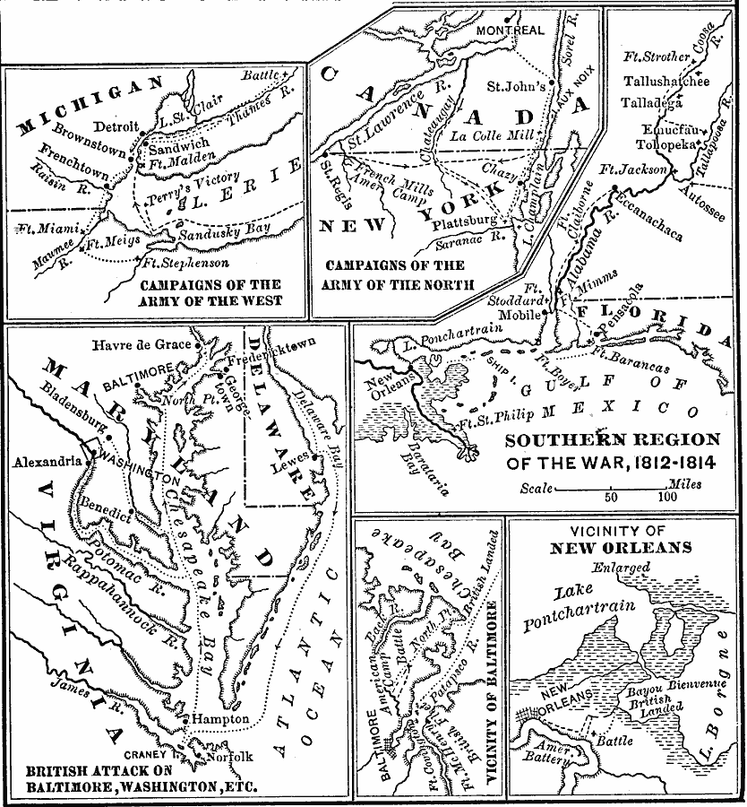
Description: A series of maps showing the principal campaigns, forts, and battle sites during the War of 1812, including details of the campaigns of the Army of the West (Fort Stephenson, Fort Meigs, Perry's victory on Lake Erie, and the Battle of the Thames River), campaigns of the Army of the North (French Mills, Montreal, and Plattsburg), campaigns of the south (Forth Strother, Tohopeka, Autossee, Fort Claiborne, Fort Mims, Pensacola, and New Orleans), and details of the British attack on Baltimore and Washington, the vicinity of Baltimore, and the vicinity of New Orleans.
Place Names: Growth of Nation, New Orleans, �Mobile, �Washington D.C., �Baltimore, �War of 181
ISO Topic Categories: boundaries,
intelligenceMilitary,
inlandWaters,
location,
oceans
Keywords: Southern Region of the War of 1812, physical, �political, �historical, �war of 1812, physical features, major political subdivisions,
local jurisdictions, other military, boundaries,
intelligenceMilitary,
inlandWaters,
location,
oceans, Unknown, 1812–1815
Source: Joel Dorman Steele, A Brief History of the United States (New York, NY: American Book Company, 1885) 160
Map Credit: Courtesy the private collection of Roy Winkelman |
|