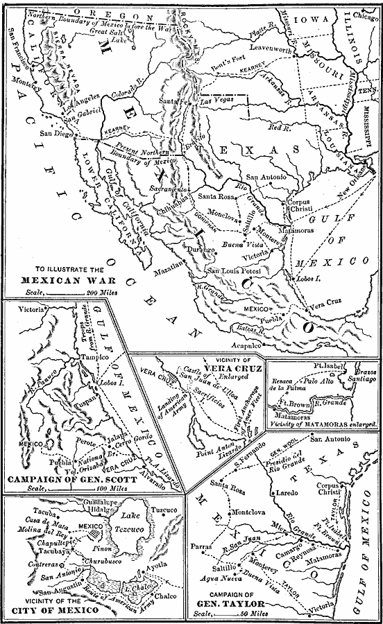
Description: A map of Mexico and southwestern United States showing the seat of war during the Mexican–American War (1846–1848). The map shows the campaign routes of Kearney, Taylor, Doniphan, Wool, and Scott, with battle sites indicated by italicized font. Inset maps detail the campaign of General Scott, the landing and battle at Veracruz, the vicinity of Matamoras on the Rio Grande, the campaign of General Taylor, and the vicinity of the City of Mexico.
Place Names: A Regional Map of North America, United States, �Mexic
ISO Topic Categories: boundaries,
intelligenceMilitary,
inlandWaters,
location,
oceans
Keywords: The Mexican–American War, physical, �political, �historical, �mexican war, physical features, country borders,
major political subdivisions, other military, boundaries,
intelligenceMilitary,
inlandWaters,
location,
oceans, Unknown, 1846–1848
Source: Joel Dorman Steele, A Brief History of the United States (New York, NY: American Book Company, 1885) 161
Map Credit: Courtesy the private collection of Roy Winkelman |
|