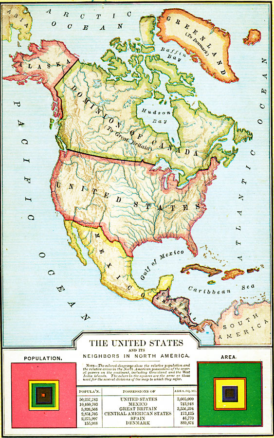
Description: A map from 1898 of North America, Central America, Greenland, and the Caribbean to Puerto Rico, subtitled "The United States and its Neighbors in North America." The map is color–coded to show the possessions of Greenland (to Denmark), Dominion of Canada (to Great Britain), Mexico, the United States, and the islands in the West Indies under Spanish control. The chart at the bottom of the map shows the relative populations at the time and the relative areas in North American possessions. The colors in the squares are the same as those used for the several divisions of the map to which they refer.
Place Names: A Complete Map of North America, Cuba, �Mexico, �United States, �Canada, �Bahamas, �Central Americ
ISO Topic Categories: inlandWaters,
location,
oceans,
boundaries
Keywords: The United States and Neighbors, physical, �political, physical features, country borders, inlandWaters,
location,
oceans,
boundaries, Unknown, 1898
Source: Edward Eggleston, The Household History of the United States and Its People (New York, NY: D. Appleton and Company, 1898) front
Map Credit: Courtesy the private collection of Roy Winkelman |
|