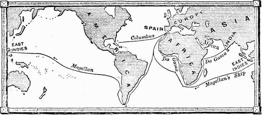
Description: A sketch map of the world from 1898, showing the voyages of Columbus to the Americas (1492), Vasco de Gama to India (1498), and the voyage of Magellan (1519–1522).
Place Names: A Complete Map of Globes and Multi-continent, Africa, �Asia, �Australia, �Europe, �North America, �South Americ
ISO Topic Categories: location,
oceans
Keywords: Columbus, Magellan, and De Gama, transportation, water routes, location,
oceans, Unknown, 1492–1522
Source: Edward Eggleston, The Household History of the United States and Its People (New York, NY: D. Appleton and Company, 1898) 12
Map Credit: Courtesy the private collection of Roy Winkelman |
|