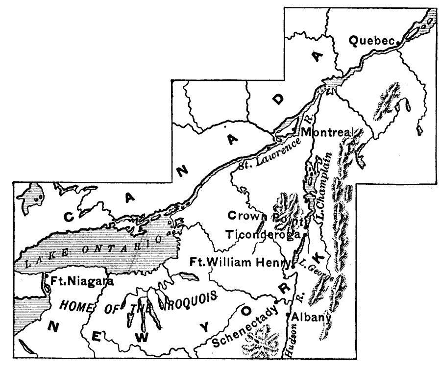
Description: A map of the region around the St. Lawrence River from Lake Ontario to Quebec, and New York to Albany. The map shows the area of the King Williams War (1689–1697), the invasion of Canada by Schuyler (1691), and Queen Anne's War (1702–1713), showing the home of the Iroquois, Montreal, Schenectady, Lake Champlain, Ticonderoga, Crown Point, Fort Niagara, and Fort William Henry.
Place Names: A Regional Map of North America, Canada, �United State
ISO Topic Categories: inlandWaters,
location,
boundaries
Keywords: The Northeast, physical, �political, �statistical, physical features, country borders, ethnological, inlandWaters,
location,
boundaries, Unknown, 1689–1713
Source: Edward Eggleston, The Household History of the United States and Its People (New York, NY: D. Appleton and Company, 1898) 123
Map Credit: Courtesy the private collection of Roy Winkelman |
|