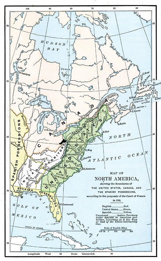
Description: A map of eastern North America at the end of the American Revolution, after numerous peace talks were held in Paris between the United States and Britain. This map shows the proposed new boundaries of the United States, English Territory, Spanish Territory, and Indian Territory on the North American continent as proposed by the Court of France in 1782. The yellow line within the Indian Territory divides the lands under protection of the Spanish and the United States.
Place Names: A Regional Map of North America, Canada, �Bahamas, �Cuba, �United State
ISO Topic Categories: boundaries,
inlandWaters
Keywords: North America, physical, �political, �historical, �spanish possessions,�spanish territory, �indian territory, �british territory, �thirteen colonies, kNativeAmerican, physical features, country borders,
major political subdivisions, American Revolution, boundaries,
inlandWaters, Unknown,1782
Source: Justin Winsor, Narrative and Critical History of North America Vol. VII (Boston, MA: Houghton, Mifflin and Company, 1888) 148
Map Credit: Courtesy the private collection of Roy Winkelman |
|