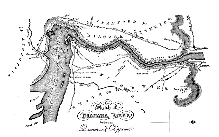
Description: A map from 1832 of the Niagara River between Queenston and Chippewa. During the War of 1812, the Niagara region became an important battleground. Fort Niagara was located on the American side and Fort George was located on the Canadian side. The most important battle occurred on October 13, 1812, when American soldiers attacked the Canadian post of Queenston. The American side was soundly defeated, however, due to poor organization. The British Major General Isaac Brock was killed in battle, which was a great loss to British forces. A monument for the Major General can be seen on the map just outside of Queenston.
Place Names: A Regional Map of North America, Canada, �United States, �Niagara Falls, �Niagara River, �Queenston, �Chippewa, �Lewiston, �New York,
ISO Topic Categories: boundaries,
inlandWaters,
society
Keywords: Sketch of the Niagara River between Queenston and Chippewa, physical, �political, �transportation, �rivers, �falls, �battles, �schools, �War of 1812, kBattle, physical features, country borders,
local jurisdictions,
major political subdivisions, water routes,
roads, boundaries,
inlandWaters,
society, Unknown,1812
Source: Justin Winsor, Narrative and Critical History of North America Vol. VII (Boston, MA: Houghton, Mifflin and Company, 1888) 383
Map Credit: Courtesy the private collection of Roy Winkelman |
|