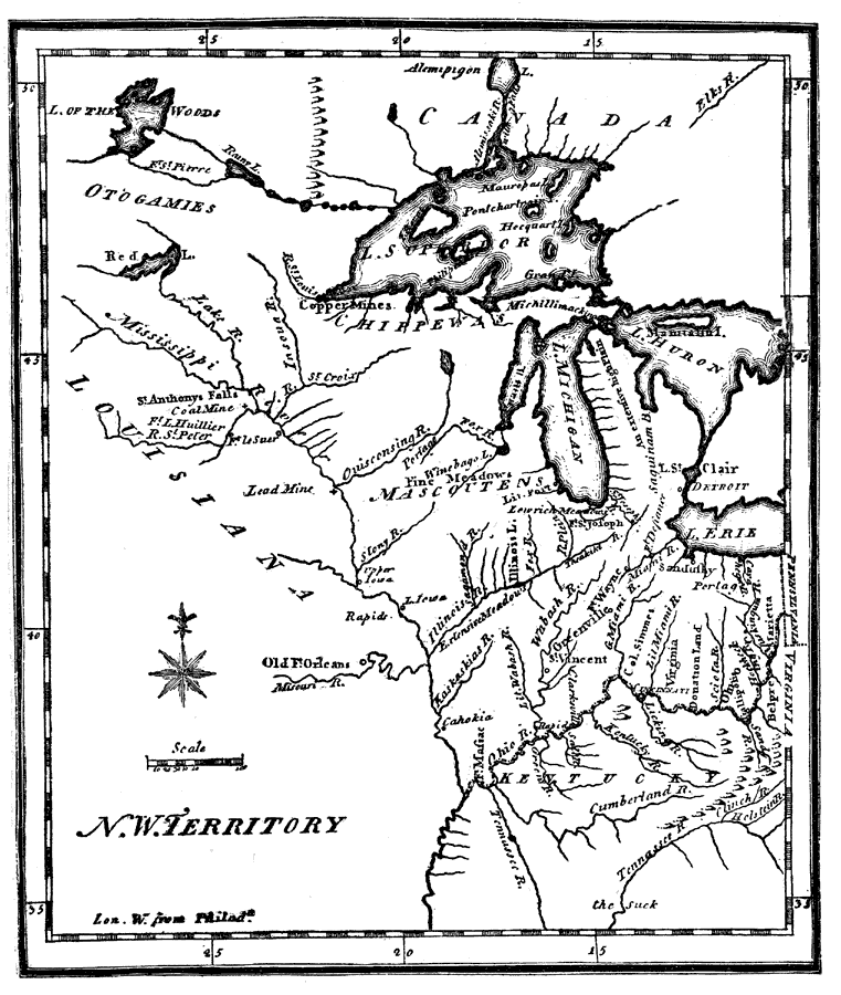
Description: The Ohio Valley and Great Lakes region after the French and Indian War (1754–1763). The Northwest Ordinance of 1787 was the first organization of land in the United States after the first 13 colonies. This ordinance set the important precedence that existing states would not expand, but new states would form and that slavery would be illegal in this new territory. Ohio was the first to gain statehood in 1803.
Place Names: A Regional Map of North America, Canada, �United States, �Great Lakes, �Michigan, �Ohio, �Illinoise, �Indiana, �Minnesota, �Wisconsin,
ISO Topic Categories: boundaries,
inlandWaters
Keywords: Northwest Territory, physical, �historical, physical features, boundaries,
inlandWaters, Unknown,1795
Source: Justin Winsor, Narrative and Critical History of North America Vol. VII (Boston, MA: Houghton, Mifflin and Company, 1888) 542
Map Credit: Courtesy the private collection of Roy Winkelman |
|