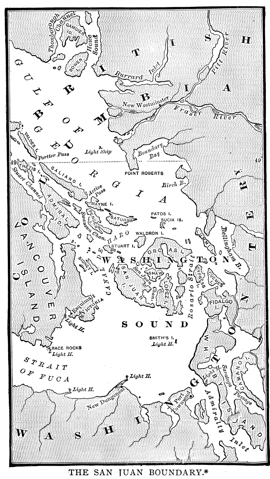
Description: A map of the Puget Sound area of North America showing the area of the boundary dispute between British Columbia and the United States. The San Juan Boundary was the source of a military conflict between the US and British North America. In the Oregon Treaty of 1846, the boundary between British Columbia and the US was defined as the 49th parallel and continued through the channel that ran down the middle. The problem with this definition was that there were two straits that this could be referring to, the canal de Haro and the Rosario Strait. The San Juan Islands were caught in between, with both sides claiming sovereignty. The conflict came to head when an American farmer on San Juan Island shot and killed a pig that was rooting in his garden. This pig was owned by an Irishman who worked for Britain's Hudson's Bay Company. British authorities threatened to arrest the American farmer. The other settlers on the island felt threatened and called for American military presence. Each side sent soldiers for a standoff that went on for days, but no one fired a shot. The issue was tenuously resolved when each side decided to decrease their military presence and stay to their side of the island. This situation continued until 1872, when the matter was turned over to Kaiser Wilhelm I of Germany. He decided in favor of the US and British troops withdrew from the San Juan Island on November 25, 1872.
Place Names: A Regional Map of North America, Canada, �United States, �Vancouver, �British Columbia, �Washington, �Gulf of Georgia, �Washington Sound, �Juan de Fuca Strait, �Strait of Fuca, �San Juan Islands, �San Juan Island, �San Juan Boundary,
ISO Topic Categories: boundaries,
inlandWaters
Keywords: The San Juan Boundary, physical, �political, �transportation, �historical, �The Pig War, �physical features, country borders, water routes, other military, boundaries,
inlandWaters, Unknown,1883
Source: Justin Winsor, Narrative and Critical History of North America Vol. VII (Boston, MA: Houghton, Mifflin and Company, 1888) 560
Map Credit: Courtesy the private collection of Roy Winkelman |
|