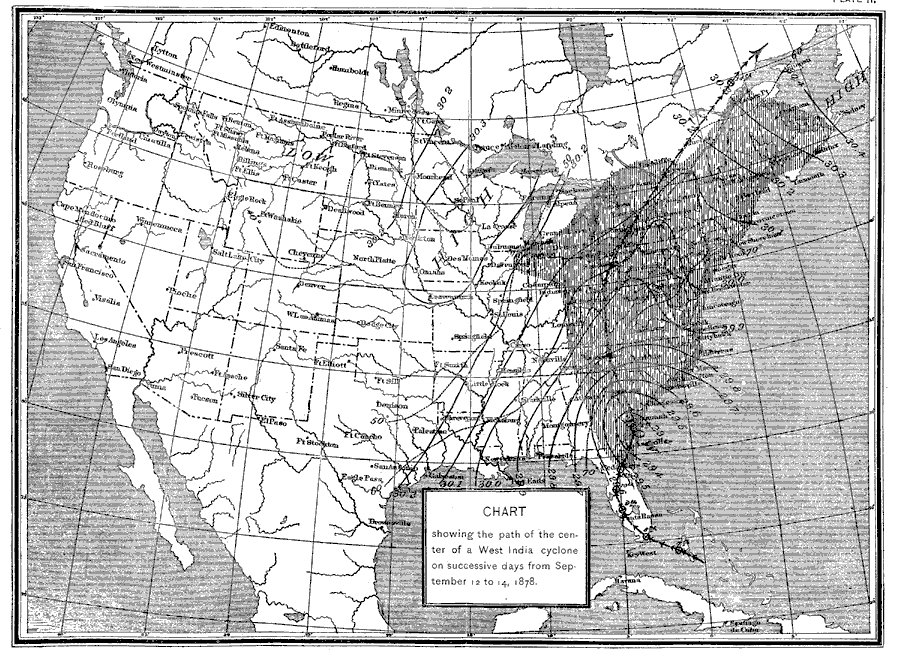
Description: A map from 1892 of the United States showing the track of a hurricane that crossed the eastern coast between September 12 and 14, 1878. This hurricane struck South Carolina on September 12, 1878 and caused at least 9 deaths before becoming extra–tropical on September 13 over Virginia.
Place Names: Meteorology, Boston, �Chicago, �Houston, �Los Angeles, �Miami, �New Orleans, �New York, �San Diego, �Seattle, �Washington D.C., �Hurrican
ISO Topic Categories: climatologyMeteorologyAtmosphere,
boundaries,
inlandWaters
Keywords: Path of a Hurricane, physical, �political, �meteorological, �hurricanes, �cyclones, �physical features, country borders,
major political subdivisions, climatologyMeteorologyAtmosphere,
boundaries,
inlandWaters, Unknown,September 12–14, 1878
Source: , Report of the Secretary of Agriculturre - 1891 (Washington, DC: Government Printing Office, 1892) 550
Map Credit: Courtesy the private collection of Roy Winkelman |
|