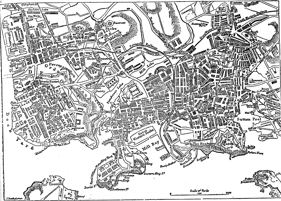
Description: A plan of the city of Plymouth from 1903. "Plymouth, a municipal and parliamentary borough and seaport town of Devonshire, England, is picturesquely situated on Plymouth Sound in the south–west corner of the county, at the confluence of the Tamar and Plym, 44 miles south–west of Exeter. With the borough of Devonport and the township of East Stonehouse it forms the aggregate town known as the Three Towns." (— Kellogg, 1903)
Place Names: United Kingdom, Plymout
ISO Topic Categories: boundaries,
inlandWaters
Keywords: Plan of Plymouth, physical, �political, �transportation, physical features, local jurisdictions, railroads,
roads,
water routes, boundaries,
inlandWaters, Unknown,1903
Source: Day Otis Kellogg, D.D., Encyclopedia Britannica Vol. XIX (New York, NY: The Werner Company, 1903) 237
Map Credit: Courtesy the private collection of Roy Winkelman |
|