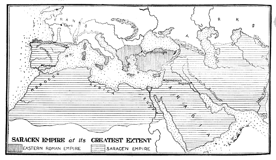
Description: " Saracens, the name applied by the ancient Greeks and Romans to the inhabitants of Northern Arabia. During the Middle Ages, the name was applied to all Mohammedans and to the Arab Moors who in the eighth century set up a kingdom in Spain, and attempted to overrun Europe. Their plan was frustrated by Charles Martel at the Battle of Tours, where the Saracens suffered a disastrous defeat. " — Foster, 1921.
Place Names: Regional Miscellaneous, Europe, �Asia, �Afric
ISO Topic Categories: physical, �historical, kWorldMedSea, kWorldAfroAsia, kWorldEurasia, kWorldEuroAfrica
Keywords: Saracen Empire at its Greatest Extent, physical, �historical, physical features, historical event, physical, �historical, kWorldMedSea, kWorldAfroAsia, kWorldEurasia, kWorldEuroAfrica, Unknown,A.D. 622–756
Source: Ellsworth D. Foster, ed., The American Educator Vol. 7 (Chicago, IL: Ralph Durham Company, 1921) 3194
Map Credit: Courtesy the private collection of Roy Winkelman |
|