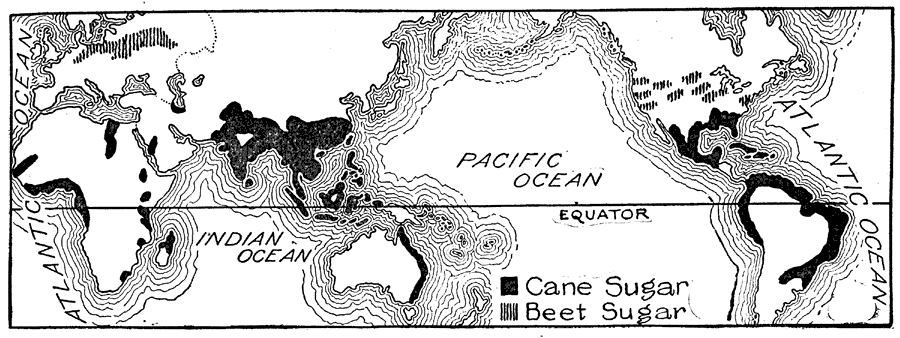
Description: A world map from 1921 showing the sugar–growing regions at the time. The map shows regions where cane sugar is grown in black, and regions where sugar beets are grown by hatchures.
Place Names: A Complete Map of Globes and Multi-continent, South America, �North America, �Europe, �Australia, �Asia, �Afric
ISO Topic Categories: farming
Keywords: Sugar Producing Regions, statistical, �historical, kAgriculture, agriculture, farming, Unknown,1921
Source: Ellsworth D. Foster, ed., The American Educator Vol. 7 (Chicago, IL: Ralph Durham Company, 1921) 3463
Map Credit: Courtesy the private collection of Roy Winkelman |
|