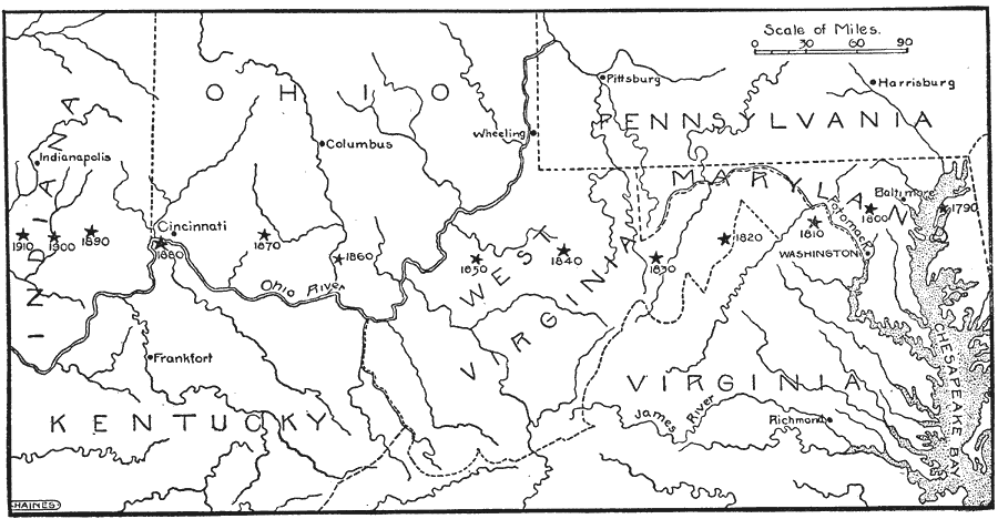
Description: A map from 1921 showing "the center of population moving westward with varying degrees of rapidity, as indicated by the stars from 1790 to 1910." — Foster, 1921.
Place Names: Demographics, Washington D.C., �Baltimore, �Harrisburg, �Cincinnati, �Columbus, �Frankfort, �Indianapolis, �Richmond, �Pittsburg, �James River, �Chesapeake Bay, �Ohio River, �Virginia, �Pennsylvania, �Maryland, �West Virginia, �Kentucky, �Indiana��populatio
ISO Topic Categories: society
Keywords: Movement of the Center of Population, inlandWaters,�rivers, �statistical, �population, �movement, �west,�physical, kPopulation, physical features, population, society, Unknown,1790–1910
Source: Ellsworth D. Foster, ed., The American Educator Vol. 8 (Chicago, IL: Ralph Durham Company, 1921) 3690
Map Credit: Courtesy the private collection of Roy Winkelman |
|