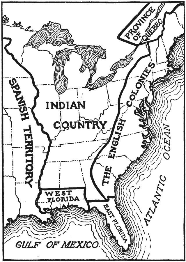
Description: A map of eastern North America showing "America at the time of the revolution." — Foster, 1921. This map shows the major divisions and boundaries of the revolutionary time period, including the Spanish Territory west of the Mississippi, West Florida, East Florida, Indian Country, English Colonies and the Province of Quebec.
Place Names: A Regional Map of North America, United States, �Province of Quebec, �The English Colonies, �East Florida, �West Florida, �Indian Country, �Spanish Territory, �Gulf of Mexico, �Atlantic Ocean, �Lake Superior, �Lake Huron, �Lake Erie, �Lake Michigan, �Lake Ontario, �Canad
ISO Topic Categories: boundaries
Keywords: America at the Time of the Revolution, boundaries, �divisions, �revolution �political, �physical, physical features, country borders,
major political subdivisions, boundaries, Unknown,1764–1789
Source: Ellsworth D. Foster, ed., The American Educator Vol. 8 (Chicago, IL: Ralph Durham Company, 1921) 3697
Map Credit: Courtesy the private collection of Roy Winkelman |
|