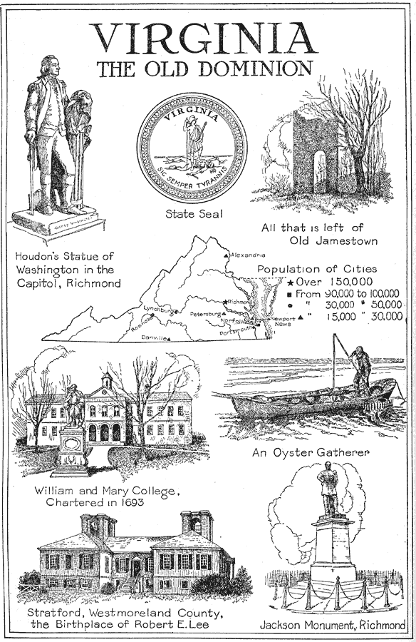
Description: A pictorial map of Virginia from 1921, showing its capital, Richmond and other major cities and inland waters. It also gives the population for each city shown. It also contains pictorial representations of Houdon's Statue of Washington, the State Seal, what is left of Old Jamestown, an oyster gatherer showing one of its primary products, William and Mary College, Stratford the birthplace of Robert E. Lee and Jackson Monument.
Place Names: Virginia, Alexandria, �Richmond, �Norfolk, �Petersburgh, �Portsmouth, �Lynchburg, �Danville, �Roanoke, �Newport News, �Roanoke River, �James Riv
ISO Topic Categories: boundaries,
location,
economy,
structure,
inlandWaters
Keywords: Virginia the Old Dominion, physical, �political, �statistical, physical features, major political subdivisions, population, boundaries,
location,
economy,
structure,
inlandWaters, Unknown,1921
Source: Ellsworth D. Foster, ed., The American Educator Vol. 8 (Chicago, IL: Ralph Durham Company, 1921) 3780
Map Credit: Courtesy the private collection of Roy Winkelman |
|