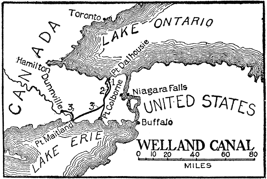
Description: A map from 1921 of the Niagara River area between Lake Ontario and Lake Erie showing the location of the Welland Canal bypassing the Niagara Falls. The Welland Canal, "a canal on the Canadian side of the Niagara River, connecting lakes Erie and Ontario, and constituting an important link in the chain of canals extending from Lake Superior to Montreal. It was opened in 1833 and in 1871 was enlarged. It is 263 miles long, 160 feet wide and fifteen feet deep." — Foster, 1921.
Place Names: A Regional Map of North America, United States, �Canada, �Lake Ontario, �Lake Erie, �Buffalo, �Niagara Falls, �Pt. Maitland, �Dunnville, �Hamilton, �Toronto, �Pt. Colborne, �Pt. Dalhousie, �Welland Canal, �Niagara Rive
ISO Topic Categories: boundaries,
inlandWaters
Keywords: Welland Canal, physical, �political, �transportation, �canalphysical features, country borders, water routes, boundaries,
inlandWaters, Unknown,1833–1871
Source: Ellsworth D. Foster, ed., The American Educator Vol. 8 (Chicago, IL: Ralph Durham Company, 1921) 3845
Map Credit: Courtesy the private collection of Roy Winkelman |
|