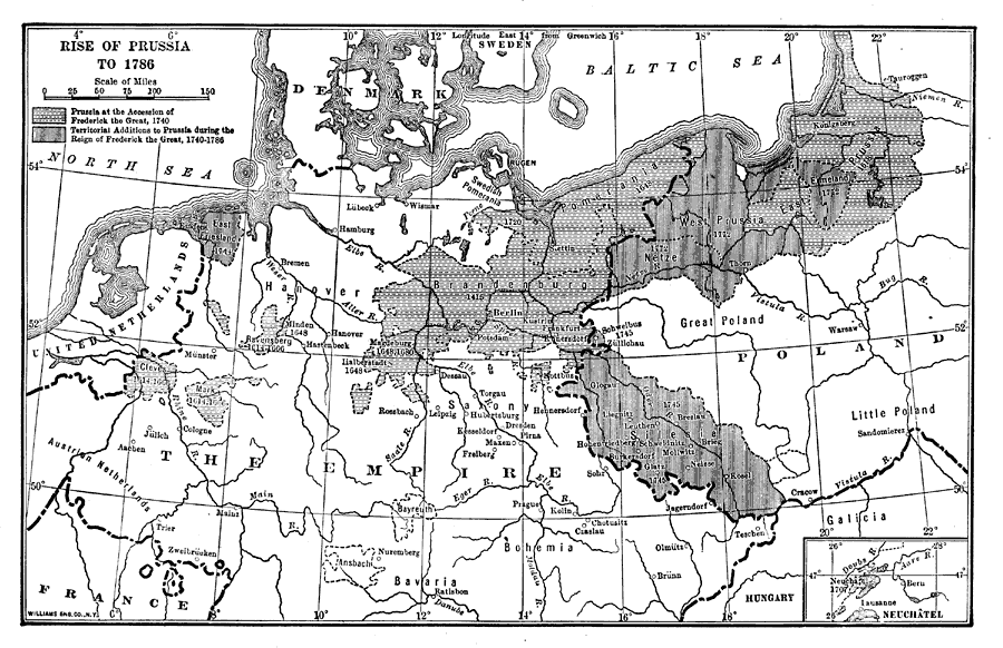
Description: This map depicts the expansion of Prussia up until 1786. Shaded are the areas claimed by Frederick the Great in 1740 and territorial additions to Prussia during the reign of Frederick the Great from 1740 to 1786. This map shows rivers and important cities, and includes an inset map of the Principality of Neuch&acric;tel on the Rhine River.
Place Names: Germany, Germany, �Prussia, �Brandenburg, �Poland, �West Prussi
ISO Topic Categories: society,
boundaries
Keywords: Rise of Prussia, historical, �political, �physical, physical features, country borders, other military, society,
boundaries, Unknown,1786
Source: Lucius Hudson Holt, A Brief History of Europe From 1789 to 1815 (New York, NY: The MacMillan Company, 1920) 32
Map Credit: Courtesy the private collection of Roy Winkelman |
|