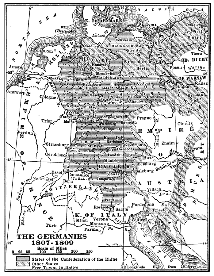
Description: A map of Germany during the Napoleonic Wars. "During the same months (March and February, 1806), Napoleon was working upon the details of another cherished plan — to organize the states of western Germany into a new confederation from which the influence of Prussia and Austria would be wholly excluded. The task was not difficult, for, as has been already indicated, the chief great powers concerned where helpless, and the Rhine countries were bound to Napoleon by ties of fear and self–interest. Talleyrand, who was entrusted with the drawing up of the necessary articles and treaties worked rapidly under Napoleon's dictation. By the final treaty, signed at Saint–Cloud July 19, 1806, the Confederation of the Rhine was organized to consist of Bavaria, Baden, Wurtemburg, Hesse–Darmstadt, Nassau, and several states, with a central Diet of two chambers, or ‘Colleges,’ at Frankfort. The new Confederation acknowledged Napoleon as its ‘Protector,’ and at once signed a close offensive and defensive alliance with France. August 1, 1806, the representatives of the several states individually and collectively announced to the Diet of the Holy Roman Empire at Ratisbon their withdrawal from the Empire. At the same time, Napoleon's envoy announced that Napoleon henceforth refused to acknowledge the existence of the Empire. August 6, 1806, Francis of Austria accepted the inevitable, relinquished his many inherited titles, and assumed the simple dignity of Emperor of Austria. Thus the old Germanic system, the Holy Roman Empire, came to an unlamented end." — Holt, 1920.
Place Names: Central Europe, Germany, �Prussia, �Berlin, �Hanover, �Saxony, �Holland, �Austria, �Bavari
ISO Topic Categories: society
Keywords: The Germanies, historical, �physical, �political, physical features, country borders, other military,
historical event, society, Unknown,1807–1809
Source: Lucius Hudson Holt, A Brief History of Europe From 1789 to 1815 (New York, NY: The MacMillan Company, 1920) 224
Map Credit: Courtesy the private collection of Roy Winkelman |
|