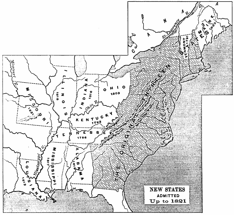
Description: A map of the United States showing the original states at the end of the American Revolutionary War (1783) and the states admitted to the Union up to 1821, with the date of admission for each new state given.
Place Names: Growth of Nation, Vermont, �Kentucky, �Tennessee, �Alabama, �Mississippi, �Louisiana, �Maine, �Ohio, �Indiana, �Illinois, �Missour
ISO Topic Categories: boundaries,
inlandWaters,
location,
oceans
Keywords: New States Admitted, physical, �political, physical features, country borders,
major political subdivisions, boundaries,
inlandWaters,
location,
oceans, Unknown, 1783–1821
Source: Edward Eggleston, The Household History of the United States and Its People (New York, NY: D. Appleton and Company, 1898) 267
Map Credit: Courtesy the private collection of Roy Winkelman |
|