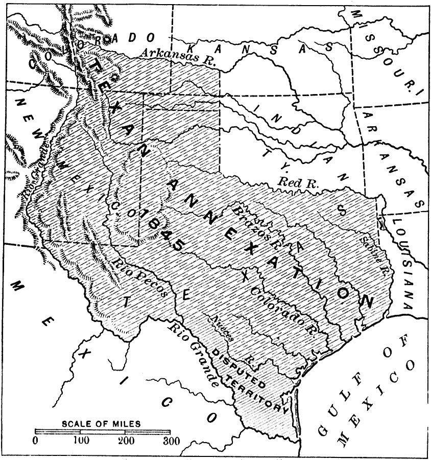
Description: A map of territory claimed by Texas when admitted into the Union in 1845. The map is coded to show the frontiers of Texas with the United States and Mexico, and the disputed territory in the west between the Rio Grande and Nueces rivers.
Place Names: Growth of Nation, Texa
ISO Topic Categories: boundaries,
inlandWaters,
location,
oceans
Keywords: Texas Annexation, physical, �political, physical features, major political subdivisions,
country borders, boundaries,
inlandWaters,
location,
oceans, Unknown, 1845
Source: Edward Eggleston, The Household History of the United States and Its People (New York, NY: D. Appleton and Company, 1898) 286
Map Credit: Courtesy the private collection of Roy Winkelman |
|